It was finally time to leave Melbourne and begin the final leg of the adventure. I must say, I was a little nervous and anxious, though I'm not sure if it was because I would finally be doing some proper offroad riding again, or because the trip was coming to an end. Either way, I was still excited about riding through the high country!
It was nearly midday by the time I had organised myself and the bike, so I didn't expect to make too much ground today. After navigating my way out of the city, I headed out to Warburton which would see me to the beginning of the Yarra ranges. It was quite surreal seeing the ranges in the distance after riding such bland terrain for so long, so I was eager to get as much enjoyment out of it as possible... of course I still have to weigh up the risks of being alone as I didn't want to break down, or injure myself. But for today at least, the riding wouldn't be anything to worry about. The ride out to and past Warburton is amazing, and would be even more enjoyable on a road bike. But it is not until you reach the northern tip of the Yarra Ranges National park that the road transforms into a well conditioned gravel road. I continued east along the northern boundary whilst looking for camp areas until I made it to Woods point. This unique little town sits in the bottom of a small valley, and is somewhere you would expect to here some deliverance banjo tunes! Nevertheless, I had a quick chat to the publican to find out where the nearest camp site is. Luckily it wasn't too far down the road and after setting up camp and preparing myself for a very cold night I was pretty confident I wouldn't have to hear or make any piggy noises ;)

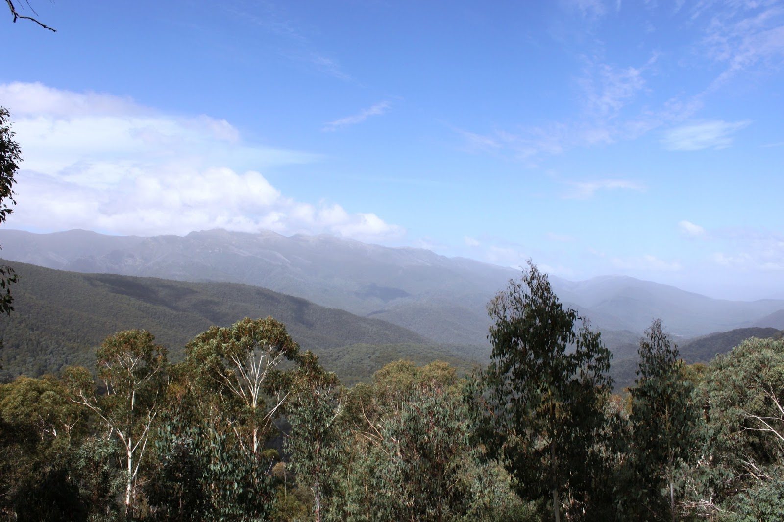
This one was taken not too far from Warburton.

The beginning of 'unsealed' stuff.
20th of March, 2013:
After the coldest night I have experienced so far, it was time to get off the main roads and into the hills. Fortunately, where I had camped there was also a 4WD group about and after speaking to them I had my route sorted for the day. The first half hour or more of today's ride consisted of 1st and 2nd gear riding through a couple of small creeks before narrow and steep hill climbs. It was great to finally be riding some different terrain, and it wasn't too long before I was off that track and onto a firetrail that would see me over Mt Singleton and Mt Selma on my way to Licola. There are some spectacular views from the top of these mountains, which really distract you from the task at hand. You can see over the surrounding ranges as well as large areas of forest that are recovering from past bushfires. It's not until you stop and shut the bike off that you hear a chorus of creaking trees that give off an eerie vibe as they all flex in the wind.
Continuing on the ride saw me turn onto South rd (from Walhalla Selma Rd) which appeared to have a 'closed' sign due to the number of falling trees. I wasn't sure if it was actually indicating the road that I had just taken was closed, or the road I needed to take was, but I either was I wasn't turning back. I continued riding the way I had originally planned which takes you back down into the valley to Licola by Jamieson Licola Rd. I figured it was time for a some lunch and by chance there were a few other riders (on road bikes) that I had a talk to. They turned out to be locals, and were familiar with the roads I planned to take on. Despite they're assurance that I would be fine to cross the Maroka Ranges (including Billy Goat's Bluff) with my set up I was still a little skeptical. Addtionally, the ride had been so slow going that in the past few hours I had only travelled around 30-40km's! I therefore decided to head south through the towns of Maffra and Stratford before heading north again to Dargo. In hindsight I really really regret this because not only was it tarmac, I also missed out on more of the Victorian high country, which I was enjoying so much!
Eventually however, I reached Dargo late in the afternoon and stopped into the pub for a few beers. There are plenty of Campsites (around seven) just up the road along the Dargo river, so I figured a couple of cold beverages wouldn't cause any drama's once I was back on the bike. I ended up going to Italian's flat camp ground, where I met a great group of people, who offered me plenty more beers and some advice on tomorrows group. I didn't really feel like cooking, and since I was given the opportunity to head back into town for a few more beers off the tap, I decided to grab a feed back at the pub instead.


21st of March, 2013:
I had really been overestimating how I far I could travel each day in this region. After spending so much time on flat, straight tarmac roads I really had to reassess my goals and capabilities. I did however think that I could still make it to Jindabyne... a goal that I had stupidly set for the previous day! It was fairly overcast in the morning and with rain forecasted for the area I really had to get a move on. I was told that it shouldn't take much more than an hour to get to Omeo if I was to cut diagonally north-east through the mountains, and given that some cattle trucks had apparently been making it through without much difficulty I figured a motorbike should be a piece of cake. I set off with the intention of taking Birregun Rd... however my attempts to find that road saw me waste around two hours, and travel only around 40km's in total after I headed back to camp for advice. It turned out the first route that I took was actually the correct one, and if I had bothered to take out my maps rather than rely on my GPS I probably would have realised that. By this time though, a light drizzle had begun and knowing that rain wasn't too far off I opted for a more straight forward route over the Dargo high plains road (which had only just reopened). It wasn't long before this road had soaked up all the moisture it had come in contact with and turned the normally hardpacked road into slippery and dangerous clay. I had to stop numerous times to ensure that my tyres were inflated and that my wheel bearings hadn't failed because the bike was handling worse than a shopping trolley!!! The weather really took a turn for the worse as I travelled along the northern section of the road within the Alpine national park. With rain, wind and fog all simultaneously becoming heavier and stronger I really had to get a move on, it was damn freezing and miserable. Eventually I turned east onto the Great Apline road where you could barely see 20 meters ahead of you, despite the tall orange snow/visibility poles. It was therefore a slow ride to Mt Hotham, where I managed to escape some of the weather and work out my next move. After contacting all of the available accommodation and finding no reasonable rate I bit the bullet and decided to continue on to at least Omeo. Here, I had organised a 'cheap' room at the Golden Ages pub. At first I kind of regretted stopping and paying for the accommodation, though it wasn't until the same storm that had caused so much damage in Melbourne passed through that I was thankful to be off the bike!

Lost: The photo doesn't show it, but this wrong road was very steep... so I turned around.

The misery! cold cold misery.

22nd - 23rd of March, 2013:
After such crappy weather the day prior it was surprising to see blue sunny skies. Because of the quick degradation of the Dargo high plains road (due to the rain) I had decided to change my original route, that would have again see me cut east through some of the ranges of the Alpine National Park and through to Seldem Seen. I figured it too would have turned into some slushy clay so instead I opted to head north to Corryong... at least the majority of the ride would still be on the dirt!
After some bacon and eggs for breaky I set off from Omeo with fairly dry gear. On my way out to Benambra, visitors were treated with a series of street signposts with a number of dead wild dogs hanging from them. Though it would have made for a unique picture, I didn't fancy sticking around to find out if I too would come to the same fate! I twisted the throttle and continued on, and today I was certain that I would make it to Jindabyne! However since the route was changed, I had to pass through thredbo first where I figured I would walk to the top of Mt kosciuszko. I arrived around 2pm, which meant I could still catch the lift most of the way up, but would have to walk the entire way back down, and I really dislike walking. I therefore decided that I would do the 13km return walk tomorrow morning instead.
It was another cold night, and a coffee or two was definitely on the cards before the long walk ahead. As you can see in many of the photo's, the morning isn't the most ideal time to do the hike because the mountains are covered in fog. If I had decided to do it an hour or two later I might have been able to see something from the top of the mountain.
Overlooking the Snowies.


After Kosciuszko, I got back on the bike and stop in at Jindabyne (finally) for some lunch. From there the roads took me to Cooma, where I would take the back roads north into the ACT. I continued on these roads through Namadgi National Park where I came across a camp ground situated at was a former space tracking station.
24th of March, 2013:
The next morning was spent riding around Canberra trying to get a couple of pics of the areas before continuing onto Goulburn before heading north past Tarlo River national park, Wombeyan Caves and finally into Abercombie national park. I didn't take too many photos today, after the big walk the day earlier, and the lack of decent sleep because of the cold I've been getting a little tired, and instead rely on the gopro to capture most things whilst riding.

The largest dish situated at the Canberra Deep space communication complex.

I figured I had to go take the usual 'postcard' pic of Canberra
25th of March, 2013:
I headed on towards katoomba, via some back roads that would eventually join onto Jenolan Caves rd. Unfortunately, from 11am to 1pm the road is closed for buses from the caves onward. This really pissed me off since I now had to turn around and backtrack towards Edith, before I could connect onto another road that would eventually connect up and get me to Katoomba. Since I was in the area, I took a couple of pictures of the 'Three Sisters' and a couple over the valley.
After negotiating the terrible traffic after Katoomba I made it to Wiseman's ferry, where I made it to the other side of the Hawkesbury River. I figured I would have made it a lot further today, with the hope of camping in the Watagans, just west of Newcastle. Instead I found another camp site within Dharug national park.


26th of March, 2013:
There were a number of different routes to take today as I headed into Newcastle. I decided to take a more western route to begin with that would see me through St. Albans and up to Bucketty via a road that runs alongside Macdonald River and old convict roads. Again, I didn't take any pics, though most of today's ride is caught with the Gopro. From Bucketty, I found some roads that would take me into the south-west side of the Watagans national park.
long story short as I'm getting sick of typing this... I finally made it to Newcastle where it was good to catch up with some friends!

I figured I had to include at least one picture from this day: Watagans National Park
29th of March, 2013:
After some catching up with friends in Newcastle, it was time to finally complete my lap of Australia. Though I did plan a longer than normal route through the Barrington Tops national park and Berrico state forests, areas where I used to ride my other bikes, I just took the main road home. The bucketts way is treacherous enough anyways.
After almost 3 months, over 1,000 litres of fuel and riding that totalled 22,852 kilometres the journey has finally come to an end. I have managed to see a great deal of Australia in comparison to what I had already, but it is still just a tiny fraction of what there is to experience out there. Though I am glad that I decided to go through with it, and push myself to complete it, travelling Australia by bike is exhausting and much more time is needed. Though I wouldn't change anything, I wouldn't attempt it again alone. The distances are so vast and in many cases lonesome, you really do have to weigh up the risks of getting stuck in the middle of nowhere. Having another person alongside you would definitely lessen this burdon, and allow for far more adventurous riding. One thing that I have found though, no matter where you find yourself in this country, you can ALWAYS count on the kindness of strangers. Simply turning up to a campsite by motorbike, and telling people of your plans gets you either a few free beers, a feed or in many cases both! When your stuck with a flat tyre, in need of directions or looking for somewhere to stay, there will always be someone friendly locals or fellow travellers there to help out.
I'd like to thank my friends and family for their support, and especially the new ones I have made along the way. A big thank you to Tyson and your family for taking me in, I really hope you have a great time on your own adventure ride (I'm already jealous!). Also, a huge thankyou to Sean and Simone, I can't thank use enough for the hospitality, help and company. I really hope to catch up with you two again if you are ever over this side of the country! Give me a yell!
Even though the trip is over, I have over 350gb of gopro footage that I have to sort through. So in the coming months I'll hopefully have a few videos completed of my ride and adventures through and around this great country!


